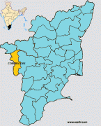
Coimbatore
Coimbatore, also spelt as Koyamputhur, sometimes shortened as Kovai , is one of the major metropolitan cities in the Indian state of Tamil Nadu. It is located on the banks of the Noyyal River and surrounded by the Western Ghats. Coimbatore is the second largest city in Tamil Nadu after Chennai in terms of population and the 16th largest urban agglomeration in India as per the census 2011. It is administered by the Coimbatore Municipal Corporation and is the administrative capital of Coimbatore District. In 1981, Coimbatore formed as the third municipal corporation in Tamil Nadu after Chennai and Madurai. Podanur Junction is the oldest railway station in Coimbatore City. The city is one of the largest exporters of jewellery, wet grinders, poultry and auto components; the "Coimbatore Wet Grinder" and the "Kovai Cora Cotton" are recognised as Geographical Indications by the Government of India. Being a hub of textile industry in South India, the city is sometimes referred to as the "Manchester of South India". It was ranked the 7th best city in India in the Ease of Living index 2020.
The region around Coimbatore was ruled by the Cheras during Sangam period between the 1st and the 4th centuries CE and it served as the eastern entrance to the Palakkad Gap, the principal trade route between the west coast and Tamil Nadu. Coimbatore was located along the ancient trade route Rajakesari Peruvazhi that extended from Muziris to Arikamedu in South India. The medieval Cholas conquered the Kongu Nadu in the 10th century CE. The region was ruled by Vijayanagara Empire in the 15th century followed by the Nayaks who introduced the Palayakkarar system under which Kongu Nadu region was divided into 24 Palayams. In the later part of the 18th century, the Coimbatore region came under the Kingdom of Mysore and following the defeat of Tipu Sultan in the Anglo-Mysore Wars, the British East India Company annexed Coimbatore to the Madras Presidency in 1799. The Coimbatore region played a prominent role in the Second Poligar War (1801) when it was the area of operations of Dheeran Chinnamalai.
In 1804, Coimbatore was established as the capital of the newly formed Coimbatore district and in 1866, it was accorded municipality status with Robert Stanes as its chairman. 24 November used to be Coimbatore Day, say those familiar with the history of Coimbatore. The city experienced a textile boom in the early 19th century due to the decline of the cotton industry in Mumbai. Post – Independence, Coimbatore has seen rapid growth due to industrialisation including the introduction of 3 malls in major locations. Coimbatore was ranked the best emerging city in India by India Today in the 2014 annual Indian city survey. The city was ranked fourth among Indian cities in investment climate by Confederation of Indian Industry and 17th among the top global outsourcing cities by Tholons. Coimbatore has been selected as one of the hundred Indian cities to be developed as a smart city under Prime Minister Narendra Modi's flagship Smart Cities Mission. Coimbatore regularly features among the top 10 best cities to live in India. Coimbatore was rated as one of the safest cities in India for women according to National Crime Records Bureau report in 2015.
There are multiple theories regarding the origin of the name Coimbatore. According to one theory, "Coimbatore" is a derivation of Kovanpudhur (literally 'new town of Kovan'), after chieftain Kovan or Koyan, evolved into Koyampuththoor and later anglicised as Coimbatore. Koyamma, the goddess worshipped by Koyan evolved into Koniamma and later Kovaiamma. Another theory states that the name could have been derived from Kovaiamma.
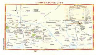
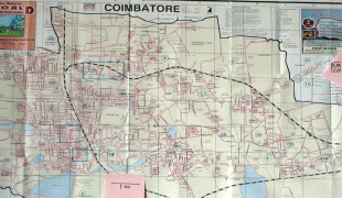
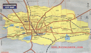
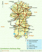
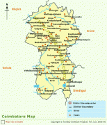
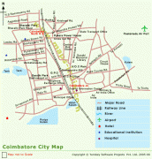
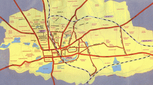
Map - Coimbatore
Map


Country - India
 |
 |
| Flag of India | |
Modern humans arrived on the Indian subcontinent from Africa no later than 55,000 years ago. Their long occupation, initially in varying forms of isolation as hunter-gatherers, has made the region highly diverse, second only to Africa in human genetic diversity. Settled life emerged on the subcontinent in the western margins of the Indus river basin 9,000 years ago, evolving gradually into the Indus Valley Civilisation of the third millennium BCE. By, an archaic form of Sanskrit, an Indo-European language, had diffused into India from the northwest. (a) (b) (c), "In Punjab, a dry region with grasslands watered by five rivers (hence ‘panch’ and ‘ab’) draining the western Himalayas, one prehistoric culture left no material remains, but some of its ritual texts were preserved orally over the millennia. The culture is called Aryan, and evidence in its texts indicates that it spread slowly south-east, following the course of the Yamuna and Ganga Rivers. Its elite called itself Arya (pure) and distinguished themselves sharply from others. Aryans led kin groups organized as nomadic horse-herding tribes. Their ritual texts are called Vedas, composed in Sanskrit. Vedic Sanskrit is recorded only in hymns that were part of Vedic rituals to Aryan gods. To be Aryan apparently meant to belong to the elite among pastoral tribes. Texts that record Aryan culture are not precisely datable, but they seem to begin around 1200 BCE with four collections of Vedic hymns (Rg, Sama, Yajur, and Artharva)."
Currency / Language
| ISO | Currency | Symbol | Significant figures |
|---|---|---|---|
| INR | Indian rupee | ₹ | 2 |
| ISO | Language |
|---|---|
| AS | Assamese language |
| BN | Bengali language |
| BH | Bihari languages |
| EN | English language |
| GU | Gujarati language |
| HI | Hindi |
| KN | Kannada language |
| ML | Malayalam language |
| MR | Marathi language |
| OR | Oriya language |
| PA | Panjabi language |
| TA | Tamil language |
| TE | Telugu language |
| UR | Urdu |